Real-time route intelligence
Know before
you go.
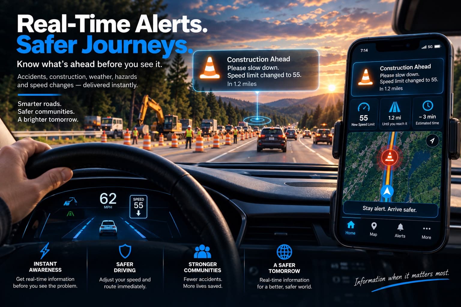
Real-time traffic, road hazard, and public-safety alerts — delivered when they matter to your route.
PathAlert watches the road ahead in the background, combines information from trusted transportation and safety sources, and warns you before crashes, closures, debris, disabled vehicles, emergency activity, or other disruptions catch you by surprise.
No need to keep a map open. Designed to work quietly in the background.
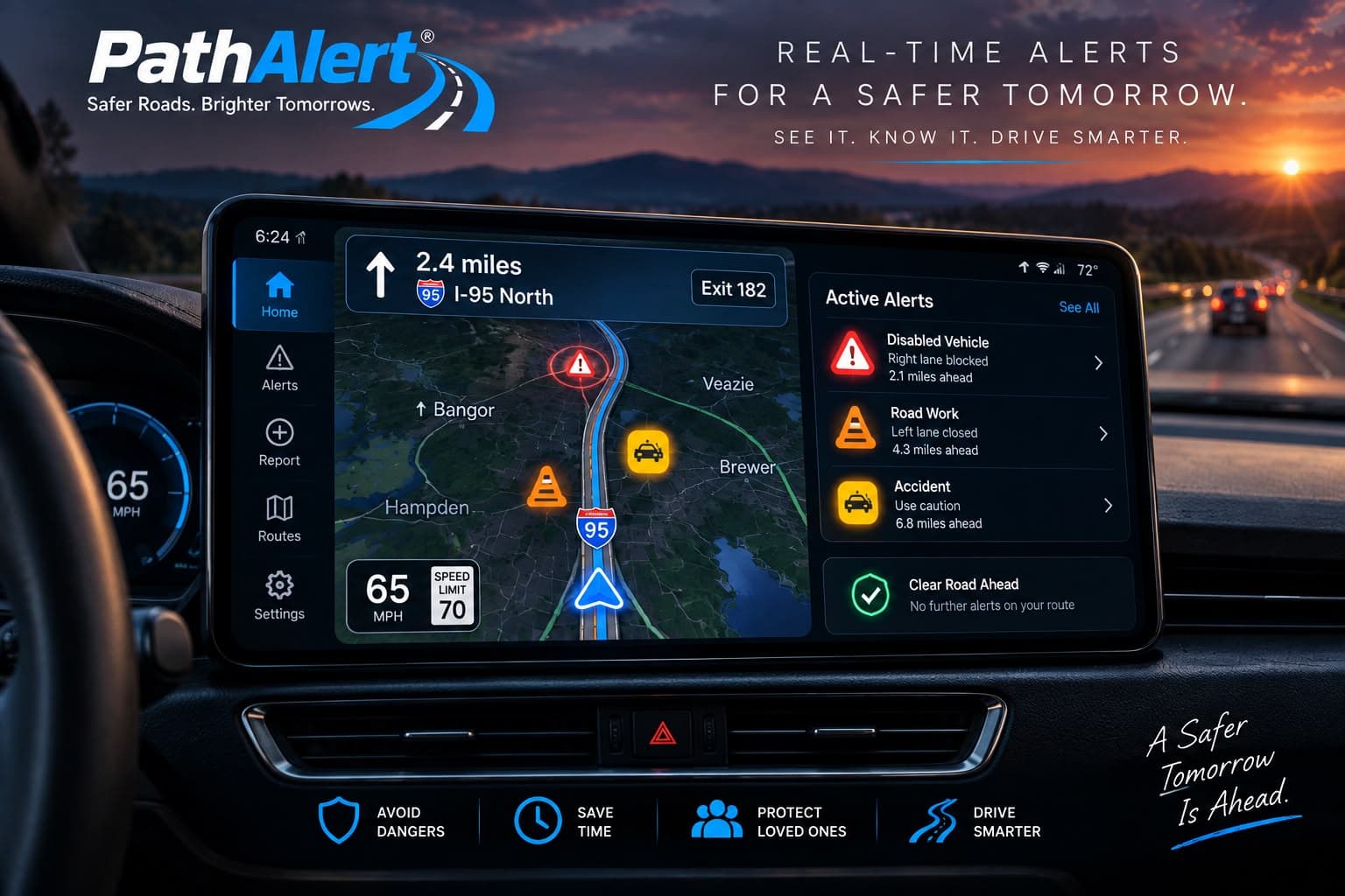
- Critical
Crash — right lane blocked
I-95 North · 2.1 miles ahead · on your route
- Caution
Work zone — left lane closed
I-95 North · 4.3 miles ahead · speed reduced
- Cleared
Earlier debris report resolved
Route 202 · event closed and removed
Illustrative example. Alerts depend on available data sources and coverage.
The information exists. You just don’t see it.
Most drivers find out after they are already committed.
A crash may be posted by police. A disabled vehicle may be on a DOT message board. A closure may appear on a 511 feed. Debris may be reported by another driver. The information is scattered across systems, and most people are not checking all of them before every trip.
PathAlert is built to bring the relevant part of that information to you — automatically.
How it works
From scattered signals to one useful alert.
PathAlert is built to collect road intelligence from multiple sources, structure it, determine whether it matters to your travel, and notify you without making you monitor another app all day.
- 01Detect
We watch the places drivers do not have time to watch.
Transportation feeds, road-condition systems, verified agency messages, public-safety updates, selected live data sources, and PathAlert incident reports can all contribute to the intelligence layer. PathAlert is designed so the platform does not depend on any one source.
- 02Understand
Raw posts and feeds are not enough.
The backend converts incoming information into structured road events: what happened, where, which direction is affected, how serious it appears, when it started, how long it may matter, and how reliable the source is.
- 03Match
Nearby is not the same as relevant.
A crash across the median may be physically close but irrelevant to your trip. PathAlert is designed to weigh the road, direction, route corridor, estimated encounter time, and event status before deciding whether you need to know.
- 04Alert
The right message at the right time.
If the event is relevant, you receive a concise notification with the road, location, impact, and a safe next action. If the event is not relevant, PathAlert stays quiet.
Road conditions change, so events can be updated, corrected, cancelled, or marked cleared — drivers are not left looking at stale warnings.
Alert types
One place for the road events that actually change your trip.
- Critical
Crash & closure
Major collisions, lane blockages, ramp closures, and road shutdowns.
- Caution
Disabled or stopped vehicle
Vehicles blocking lanes, ramps, or shoulders, or creating a dangerous roadside condition.
- Caution
Debris & animals
Objects, cargo, tires, fallen branches, dead animals, or other hazards on or near the roadway.
- Caution
Weather & road condition
Flooding, ice, washouts, downed trees, low visibility, and sudden road-condition changes.
- Planned
Construction & work zones
Planned or emergency work that affects lanes, speed, or access.
- Priority
Active public-safety incident
Verified or high-confidence emergency activity that may cause sudden closures, detours, or dangerous conditions.
PathAlert provides supplemental travel information. Conditions can change faster than any digital system can report them, and not every event will be detected. Drivers remain responsible for safe driving and for following official road controls.
Not another navigation app
Keep your GPS. Add the intelligence it is missing.
PathAlert does not need to replace Apple Maps, Google Maps, or Waze. It is designed as an additional safety and awareness layer. When you need navigation, PathAlert can hand you off to your preferred map app. When you do not have a map open, PathAlert can still be watching for relevant disruptions.
- Your map app
- Turn-by-turn directions, lane guidance, and arrival times — opened when you need them.
- PathAlert
- A background intelligence layer that watches for route-relevant disruption whether or not an app is open.
- Together
- Awareness first, navigation second. PathAlert tells you something changed; your map app gets you around it.
Active incidents
Sudden public-safety events can change a road in seconds.
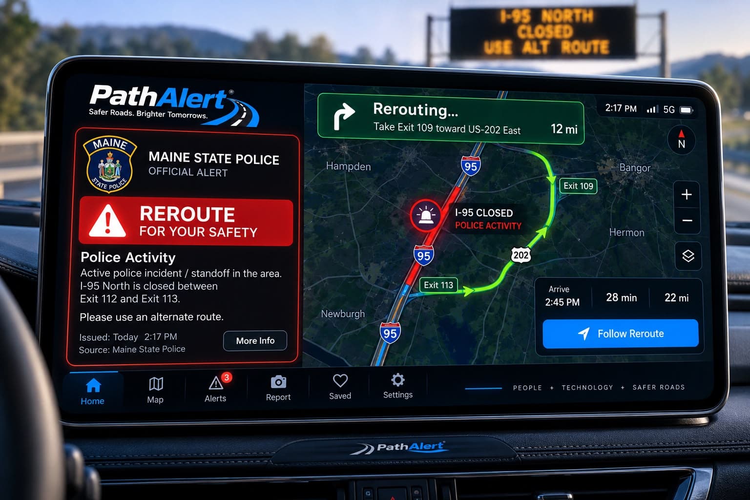
Emergency response, hazardous scenes, and other public-safety activity can create closures or dangerous conditions before traditional traffic data catches up.
Where the information comes from a verified or sufficiently reliable source and is relevant to your route, PathAlert can treat these as high-priority situational-awareness alerts — telling you that a road may close or a detour may appear, and nothing more.
What an alert looks like
“Road restrictions reported ahead — avoid area. Sudden closures may occur.”
This is road-safety and travel-impact intelligence. PathAlert is not a police-tracking tool, does not report the movements of officers or individuals, and does not publish operational law-enforcement detail.
Report it
See a problem? Report it in seconds — once you are safely stopped.
PathAlert can turn drivers into an extra set of eyes for the road, without turning the app into a social network. If you notice debris, an animal, a disabled vehicle, a vehicle in a ditch, an accident, flooding, or road damage, you can drop a location-based report.
Where supported, PathAlert can route that report toward the responsible DOT, police agency, public works department, or road operator. Other drivers can be warned when the event meets confidence and relevance rules.
Reporting safely
Never type, photograph, or interact with your phone while driving. Reporting is designed for passengers, or for drivers who have come to a safe and legal stop. Optional details such as photos and notes are deferred until the vehicle is stationary.
Reportable categories
- Accident or crash
- Vehicle in a ditch or off the roadway
- Disabled vehicle
- Vehicle blocking a lane or ramp
- Animal on or near the roadway
- Debris, tire, cargo, or branch
- Flooding or washout
- Downed tree or utility hazard
- Large pothole or road damage
Agency Broadcast
A direct digital lane from agencies to affected drivers.
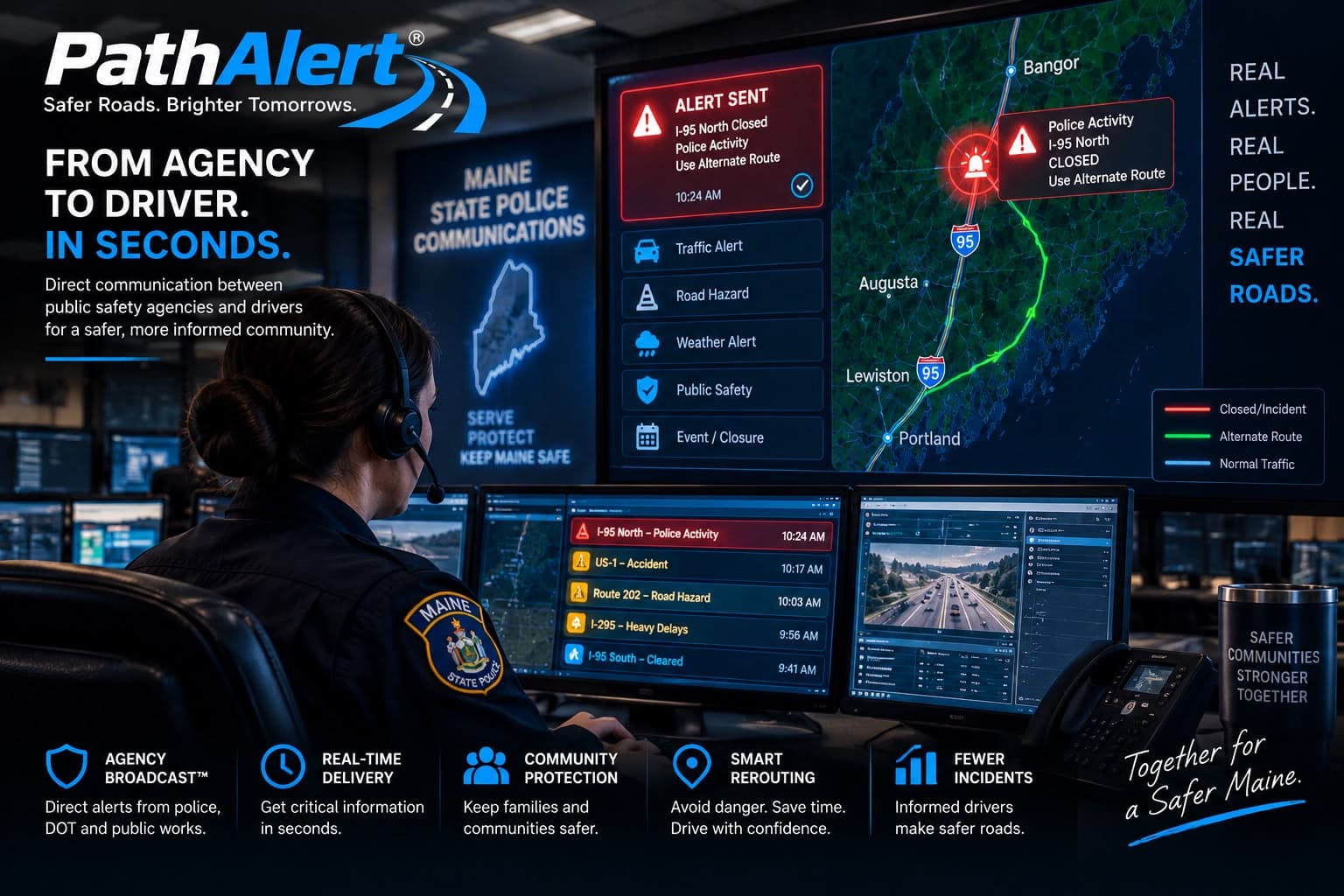
PathAlert Agency Broadcast is designed to give verified DOT, police, emergency management, and public works organisations a way to publish road events directly into PathAlert. Instead of sending the same notice to everyone, PathAlert can determine which drivers are actually approaching the affected road, direction, or corridor.
Agencies can publish, update, cancel, and clear events while preserving an audit trail.
PathAlert is designed to supplement — never to replace — highway signs, 511 systems, emergency alerts, and other required communication channels. Not every driver has the app, connectivity, or notifications enabled.
Agency participation is established through a verification and onboarding process. PathAlert does not claim an agency partnership that is not in place.
PathAlert Guardian
Crash awareness for vehicles that were never built with it.
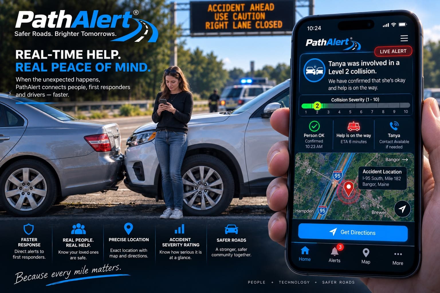
Many modern vehicles include built-in emergency notification. Most older vehicles do not. PathAlert Guardian is an optional universal in-vehicle module designed to bring crash detection and family or fleet notification to vehicles that were never built with connected safety.
If Guardian detects a potential severe collision, it is designed to capture the vehicle location and event time and notify the contacts you have configured. A response workflow can ask the driver whether they are okay and escalate to those contacts when there is no response.
Important limitation
Guardian is a supplemental crash-detection and notification device. It is not a guaranteed emergency-response service and does not promise automatic 911 dispatch. In an emergency, call emergency services directly. Detection depends on the nature of the impact, connectivity, power, and configuration.
For families
More awareness when the people you care about are on the road.
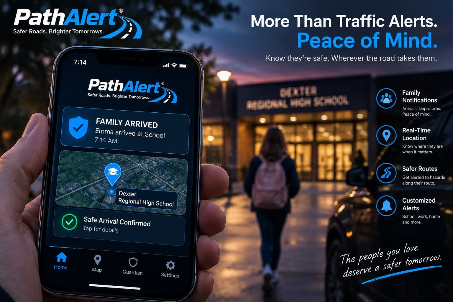
PathAlert combines background road alerts with optional Guardian crash notification, so families can have more context about the roads their drivers use and about serious incidents involving supported vehicles.
- Background road, hazard, and closure alerts
- Active incident awareness along familiar routes
- Optional Guardian crash notification
- Family contact escalation you configure yourself
- Vehicle location after a detected serious event, subject to permissions
Permission-based and transparent
Family features are opt-in and visible to the people involved. Everyone in a family group can see what is shared and with whom. PathAlert is built for safety, not covert surveillance, and is not marketed as a way to track someone without their knowledge.
Fleet & enterprise
Fewer surprises for every driver you manage.
PathAlert Fleet brings road intelligence into daily operations. Dispatchers and business owners can see disruptions affecting multiple drivers, receive fleet-level alerts, and react before crews drive into avoidable delays.
One avoided 30-minute delay, multiplied across a team of technicians, delivery vehicles, or service calls, adds up quickly. PathAlert is designed to turn earlier awareness into operational savings.
- Driver and route groups
- Central alert dashboard
- Disruptions mapped to affected drivers
- Manager and driver alert routing
- Incident audit trail
- Optional Guardian hardware
- Configurable severity policies
- Future API and telematics integrations
Technology & trust
Built to reduce noise, not create more of it.
An alert you learn to ignore is worse than no alert at all. PathAlert is designed around relevance rather than volume.
Route-aware, not just nearby
An incident across the median is not your incident. Relevance is judged against your road and corridor.
Direction-aware where data allows
Where the source supports it, PathAlert can distinguish which side of the road is actually affected.
Confidence-scored and source-aware
The backend assigns source trust, and verified agency sources can be clearly identified as such.
Duplicate-suppressed
Multiple reports of the same event can be merged into a single alert instead of a burst of notifications.
Short-lived events expire
Events carry a lifecycle — active, updated, cleared, cancelled, expired — so stale warnings disappear.
Privacy built into the architecture
Processing is server-side, retained precise location is minimised, and individual routes are not exposed to agencies.
Coverage depends on available data sources, agency participation, cellular coverage, and platform permissions, and will expand region by region. PathAlert does not claim to see every road event or every traffic source.
Questions
Straight answers.
Is PathAlert another GPS app?
No. PathAlert is an alert and route-intelligence layer. Use your preferred navigation app for turn-by-turn directions — PathAlert is designed to sit alongside it, not replace it.
Do I need to keep PathAlert open?
No. PathAlert is designed to provide alerts in the background, where platform permissions and settings allow.
Where does the information come from?
PathAlert is designed to combine transportation data, verified agency alerts, selected public-safety information, trusted live data sources, and user road reports. Source trust is scored, and duplicate reports can be merged into a single event.
Can anyone send an official DOT alert?
No. Agency Broadcast publishing is intended for verified organisations and authorised users with controlled permissions.
Will Guardian call 911?
PathAlert does not promise automatic emergency dispatch. Guardian is a supplemental crash-detection and notification device that alerts the contacts you configure. Automatic dispatch would require a certified, contracted, and jurisdictionally supported emergency-service integration, and is only ever offered where such an integration is actually enabled.
Can parents track their kids?
Family location features are permission-based and transparent to everyone in the family group. PathAlert is intended for safety, not covert surveillance.
What if an alert is wrong?
PathAlert uses source validation, confidence scoring, deduplication, updates, and expiration to reduce bad information. Users and verified agencies can also update or clear events where supported.
Will it work everywhere?
Coverage depends on available data sources, agency participation, cellular coverage, and platform permissions. Coverage will expand region by region.
